Living with the past
 Anyplace you go in the mid Atlantic region of the United States, you just can't get away from history.
While you may not be fully aware that it surrounds you, just think of all the place-names:
Rappahannock, Shenandoah, Potomac, Susquehanna, Catoctin, Massanutten, Allegheny, Cacapon, Roanoke... Native American in origin, yet they are fixtures in today's life. US Routes 11, 340 and 220 all follow Native American trails down the valleys, through the mountains of PA, MD, WV and VA and more.. trails that were subsequently used by European settlers as they expanded north, south and west of the main immigration ports in the East.
Sadly, much, if not most, of the physical evidence of indigenous culture has been erased or destroyed.
So, too, for much of the physical evidence of early European settlers...
Place names like "Frog Eye", "Rough and Ready", "Freetown", "Big Lick", "Tight Squeeze", "Good Luck", and "Hell-Town".. are merely echoes of the past, passed down thru oral tradition and fading memories.
But, some physical traces are still there, if you are patient, observant, and willing to explore. (please do so on either public land or with landowner permission please!... and remember to leave any artifacts you may find..discovery is a wonderful thing for others who come after you!)
Perhaps the most important attribute of someone searching out evidence of the past is an acute awareness of the present. The terrain, plant communities, patterns of disturbance.. all come into play, as do powerful detailed observations.
Almost any land area that has been left fallow, and then eventually reforested, will have similar details that can be "discovered" and can help unlock the mystery of past land uses.
When we go out, wandering, (again, on public lands or private lands with permission), in addition to the occasional use of old maps, we rely primarily on our powers of observation.
Other indicators are the many piles of rock, often found in the middle of a forest... evidence of the work that had been required to clear rock-littered mountainsides for orchards, fields, pastures and gardens.
Harder, still, to see are the disused charcoal hearths and copper mines.
Charcoal hearths (where charcoal was produced from harvested wood) were, and are, crescents of level ground dug from the mountainsides... reminders that one of the very first industrial uses of the forests and the mountains, was to make charcoal.. to fire the fledgling industrial age's demand for energy.
The copper mines, all hand dug, are merely depressions, near a raw rock face.. sometimes surrounded by tailings, with telltale splashes of beautiful, blue-green copper oxide.... Both of these features are normally under a deep layer of leaves... nature's way of reclamation.
 And of course, any industrial use of the land required "roads".. much rockier and hardscrabble than anything we consider a road by today's standards.
Many of the trails in Shenandoah National Park and elsewhere in the region had their origin as mountain roads for both social and industrial uses...
************************************************************************************************
So, while we have been doing this for a long time, each of you has the ability go out and explore, and discover your own historical "treasures" wherever you are. You don't need a metal detector, or even an old map... you just need to have a willingness to immerse yourself in the environment and to observe with an open mind. (and permission to be on the land)
Here, in the mountains, we used some of the following clues to help us find historical land uses and sites... These are clues that you can use wherever you are... be it Petersburg VA or Petersburg WV... Harrisburg PA or Harrisonburg VA... or points in between!
On a recent hike, we found these signs of historical land uses:

The trail we were hiking crossed a slight rise that had a lot of rocks oriented in a line perpendicular to the trail... an old stone wall. Again, the best way to "see" this is to look for patterns.. a low ridge or raised area that travels in a strait line is usually man-made... if it is rocky, and the surrounding ground is relatively rock-free, then you have the trace of a stone wall.

A spring is where water from an underground aquifer comes to the surface of the ground. Water from springs, "spring water", not only provided a potable water source, but a source of cooling for dairy products.... and occasionally distilled corn products as well.
Springs were highly valued resources. The actual source, where the water emerges from the ground, was normally protected by being enclosed in walls and an overhead covering.. hence a "spring box". The outflow from a spring was also protected by a "spring house", thru which the channelized, cold spring water could flow, protected from sun and contamination. Here, you can see the protected source and the remains from the channelized outflow.

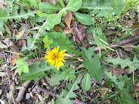
As an additional source of income and food, you can, sometimes, find watercress still thriving in the clear, cool water, especially if there remains enough sunlight. This "patch" of watercress remains near the outfall and in fact has spread to sunny spots down stream...
The process that occurs naturally when a plot of cleared land (thru fire or agricultural/industrial uses) returns to a forested state is called "plant succession".. grasses give way to woody shrubs, which in turn give way to pioneer species of trees - Virginia pine, black locust, white pine before ultimately returning to the predominate hardwood species for this region .. known as a mature or climax forest.
A significant amount of the inhabitation of the hills and hollows came to an end in the last century because of 2 conditions: The creation of National and State parks and the Great Depression which led to a migratory wave away from the rural mountainous regions toward more urban and suburban environs.This left land, homes, farms, orchards, all cleared, to return to a forested state.. thru plant succession.
What that means to a person looking for clues, is that if you can find islands of large specimens of pioneer species of trees, black locust and white pine particularly, then you have found an area with a high probability of having been, at one time, cleared. In the distance of this next picture, you can see a mature white pine community .... a mountaintop homesite.


The discovery of a potential old homesite, can be further reinforced by finding "wolf trees".. trees that were mature "landscape features" when the site was still cleared and inhabited...
When trees are allowed to grow in an open environment, where there is no competition for sunlight, their limbs spread widely... as the forest grows up around them, those limbs slowly die and fall off, as the tree becomes more competitive for sun and focus more energy in growing up.
I hope this provides you with some tools for doing your own exploration and interpretation..
While doing this hike, we also made an amazing discovery about another site..
The next article is going to be about a "Hole in the Ground", and a flat road... We are still doing background research as a follow up.
In the meantime, get outside, leave the crowds behind and explore.. take a camera, a friend, some water, and don't forget to tell someone where you are going... or you can call us, we will gladly go with you!


Comments
Post a Comment